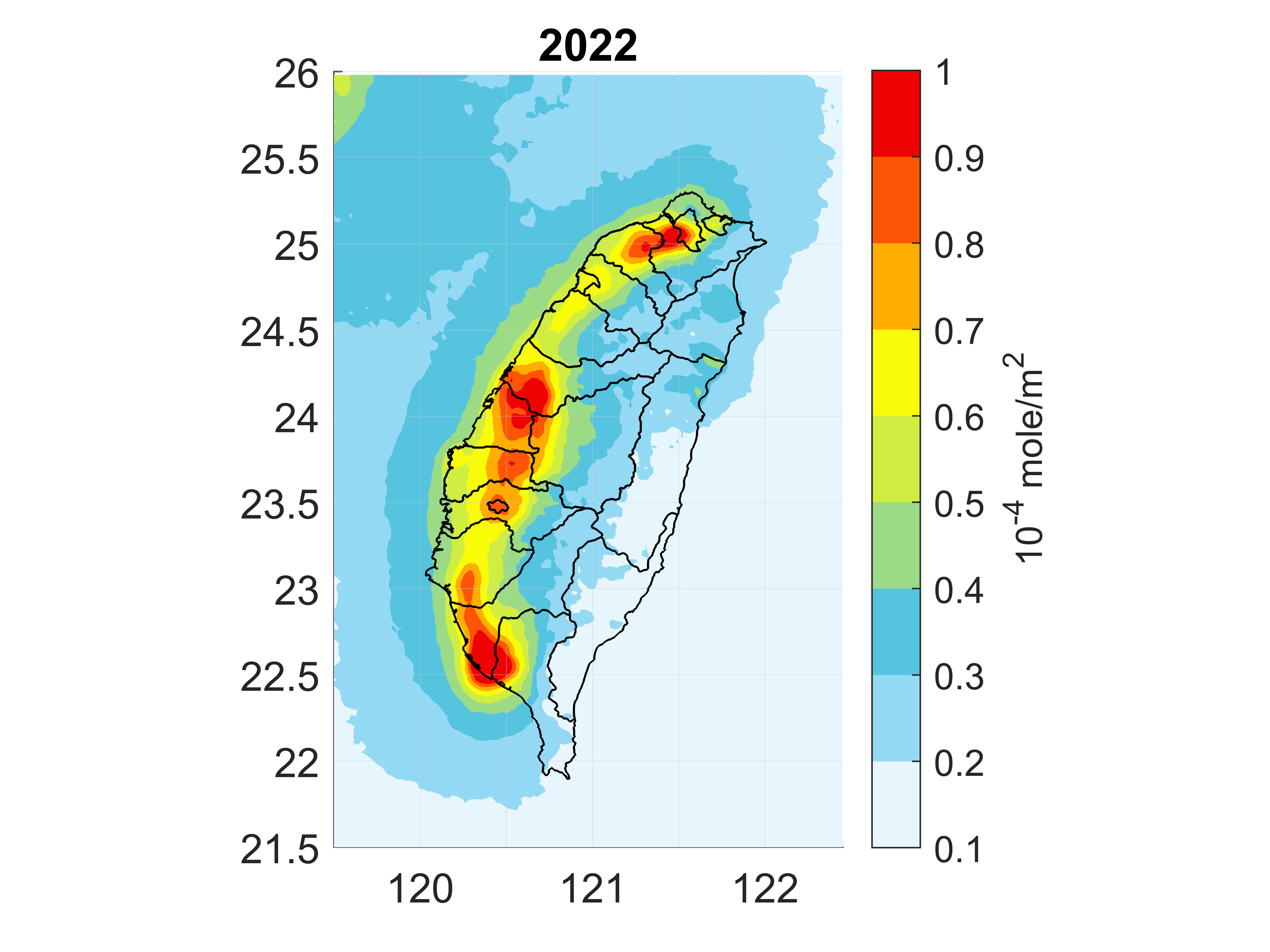
此圖為2022年由衛星所觀測的臺灣平均二氧化氮(NO2)柱狀密度,衛星資料是由地球觀測衛星Sentinel-5P上所搭載的TROPOMI (TROPOspheric Monitoring Instrument)儀器所觀測的,圖中可清楚看到臺灣西半部都會區、工業區、和交通的二氧化氮熱點。
This image shows the average nitrogen dioxide (NO2) column density over Taiwan observed by satellite in 2022. The satellite data was measured by TROPOMI (TROPOspheric Monitoring Instrument) onboard the Sentinel-5P Earth observation satellite. In the image, you can clearly see nitrogen dioxide hotspots over the urban areas of western Taiwan, as well as industrial zones and transportation.