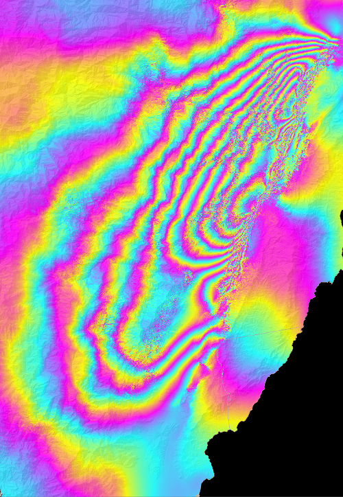
2022年9月18日臺灣東部池上地區發生規模6.9的陸上地震,造成中央山脈一側向上與向南位移的地表變形,並由日本大地二號合成孔徑雷達衛星偵測到。圖中的合成孔徑雷達干涉環,每一圈代表的變形量約為12公分。
A Mw 6.9 earthquake occurred on 18 September 2022 in Chihshang, Eastern Taiwan. The Central Range has moved upwards and southwards during this earthquake, and this ground deformation was detected by the Japanese ALOS-2 SAR satellite. Each interferometric fringe in the figure represents 12-cm displacement.