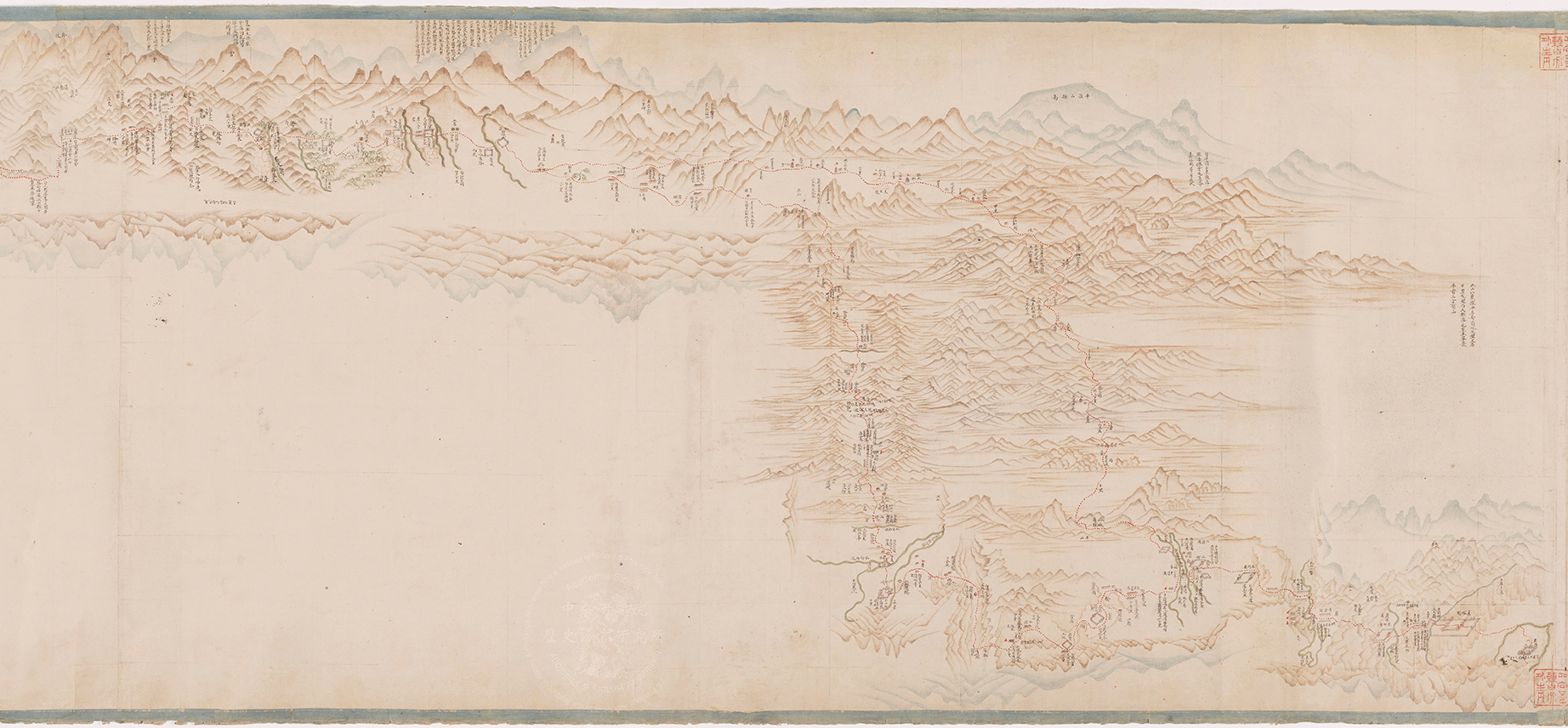
蘇寧阿|乾隆三十八年(1773) 此圖主體為大幅新疆地圖,體現十八世紀後期清朝內地通往天山南麓沿路之自然與人文地理。 Suningga|1773 The main part of this scroll is a large map of Xinjiang, showing the natural and cultural geography along the areas from China proper to southern Tian Shan under the reign of the Qing dynasty in the late 18th century.